Selected Research Projects
Website: projectmekongnasa.appspot.com
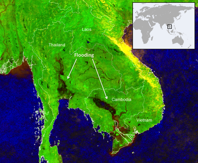
Description: A near real-time flood monitoring and impact assessment system for Southeast Asia
Role: Lead scientist, full stack developer
Institution: NASA Applied Sciences Water Resources Program
More Info:
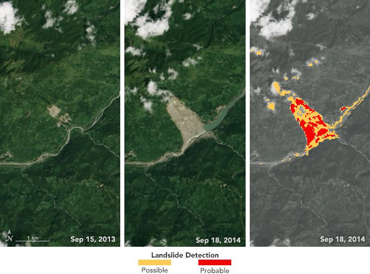
Description: An automated landslide detection system and near real-time extreme precipitation monitoring framework for Nepal.
Role: Scientist, software developer
Institution: NASA DEVELOP
Media:
- Using NASA Data to Automatically Detect Potential Landslides in Nepal
- NASA Earth Observatory
- Detecting Landslides in Nepal with Landsat
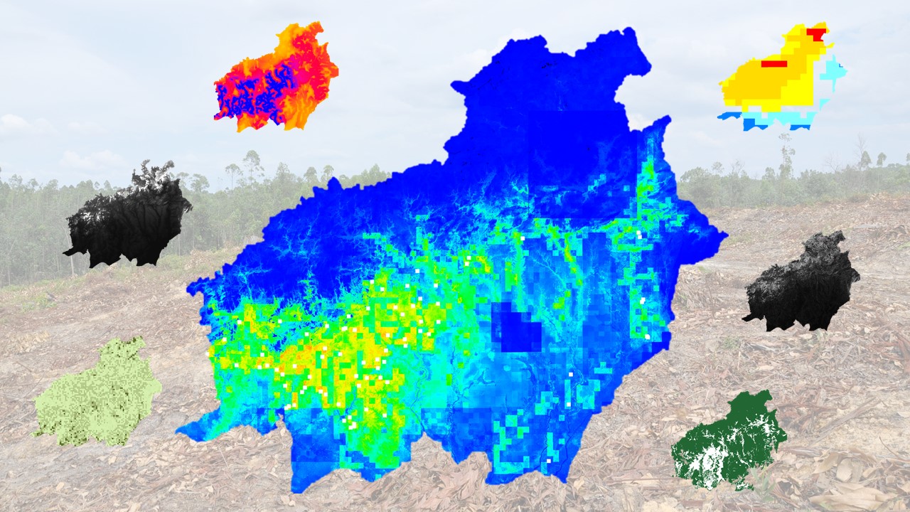
Description: Using historical deforestation data and fuzzy logic MaxEnt models to forecast future problem areas in Indonesia
Role: Proposer, Scientific Advisor
Institutions: NASA DEVELOP and World Wildlife Fund
More Info: NASA LPDAAC article
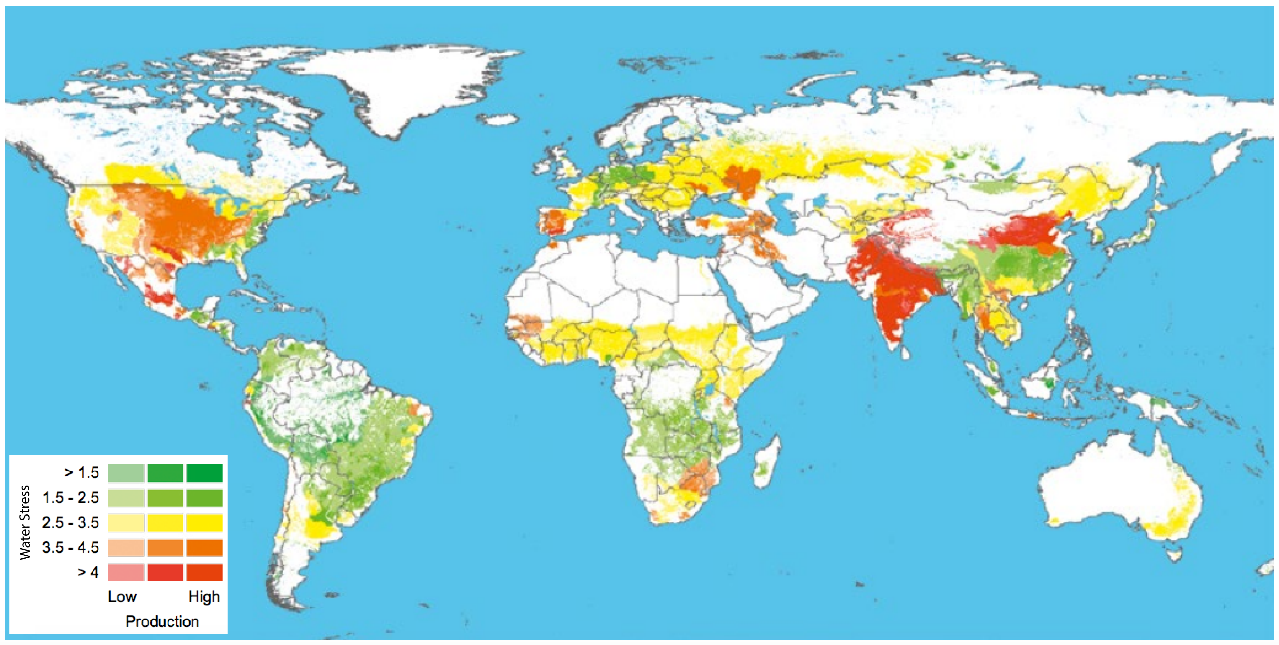
Description: Integrated water and standards assessment framework for agricultural water use
Role: Research Analyst, Lead GIS Analyst
Institution: World Wildlife Fund
More Info: Publication
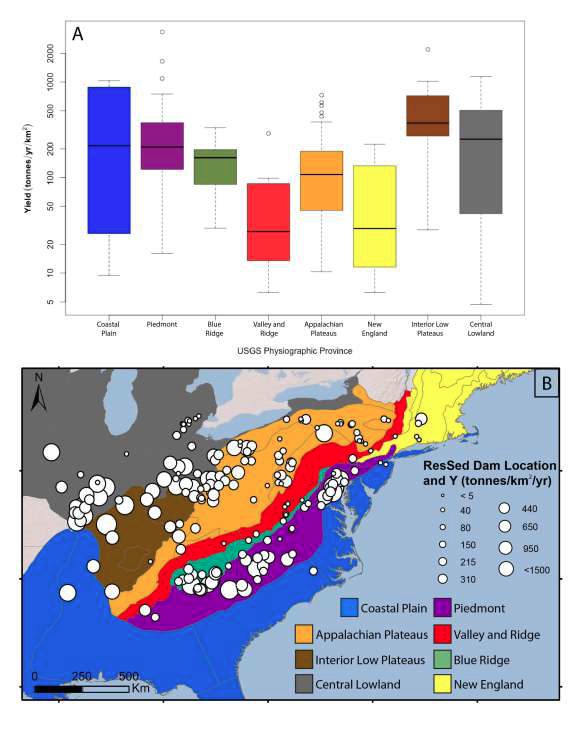
Description: Statistical analysis of anthropogenic and geophysical factors influencing erosion rates
Role: Researcher
Institution: Boston College
More Info: AGU Abstract, GSA Abstract, Full Thesis
Role: Researcher, GIS specialist
Institution: Boston College
Media:
